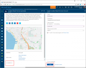
Azure Location Services
Every consumer and enterprise have need of one service – Location Services. Azure location services in this respect has changed the way this has to be manually handled.
Azure location services can help solve multiple different problems
-
Search – Multiple different applications required to provide details about the point of interest including various contact information, periods and hours of operations, a pinpointed locations on the map to provide contextual info about that area and many time different ways to get there including by walking or driving
-
Maps – Multiple different solutions require integration of maps into the solution to provide map control or just rendering of maps over existing layer. These maps update dynamically to provide customers with relevant information based on their location and or various interaction they are doing with regards to application . for eg. ordering service or a retail shopping experience or just vacations
For Ex – Code to create start and end point could not have been more easier as below
// Create the GeoJSON objects which represent the start and end point of the route
var startPoint = new atlas.data.Point([-122.130137, 47.644702]);
var startPin = new atlas.data.Feature(startPoint, {
title: “Microsoft”,
icon: “pin-round-blue”
});
var destinationPoint = new atlas.data.Point([-122.3352, 47.61397]);
var destinationPin = new atlas.data.Feature(destinationPoint, {
title: “Contoso Oil & Gas”,
icon: “pin-blue”
});
Even for multiple points the code is much simpler
// Fit the map window to the bounding box defined by the start and destination points
var swLon = Math.min(startPoint.coordinates[0], destinationPoint.coordinates[0]);
var swLat = Math.min(startPoint.coordinates[1], destinationPoint.coordinates[1]);
var neLon = Math.max(startPoint.coordinates[0], destinationPoint.coordinates[0]);
var neLat = Math.max(startPoint.coordinates[1], destinationPoint.coordinates[1]);
map.setCameraBounds({
bounds: [swLon, swLat, neLon, neLat],
padding: 100
});
// Add pins to the map for the start and end point of the route
map.addPins([startPin, destinationPin], {
name: “route-pins”,
textFont: “SegoeUi-Regular”,
textOffset: [0, -20]
});
-
Geocoding – New apps are able to turn latitude and longitudes into recognisable roads and street addresses and also able to generate short links or targets to a particular or a street address which finally results into lat-long cordia=nates. This data is very important to ensure not only directions information is correct, the search is properly able to provide recognisable and accurate results but also for the accuracy of shipment and contextual use of this data to the application
-
Routing – Delivery application or driving applications both need a shortest possible route from location A to B either to help the customer or to help the delivery team provide shipments at the right time.
